
A mountain historical perspective. The Hindu Kush the foothills of the Himalayas....

The above picture comes from a magazine on the Mercedes Gwagen and talks about the PRT and the Canadian Forces in Afghanistan in 2005/ 2006.
The picture is a bit unique as it was 6 years ago to the day January 13, 2006 that the picture was taken atop a mountain outside of Kandahar city. The very route that Alexander the Great took to enter the small town that would soon be known as Kandahar (Archosia it means Alexandria in an old Pashtun dialect) can be seen on the left of the picture...
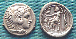 |
Silver coin of Alexander the Great |
I am standing behind the Canadian flag with a big grin on my face.... my comrades from B Company (Mountain), 3rd Battalion, Princess Patricas Canadian Light Infantry are beside me. The very vehicle (Jenna) that I would be attacked in on January 15, 2006 is in the small picture upper left.... it saved my life and the lives of Corporal Jeff Bailey, and Private William Salikin.
The mountain we climbed was difficult as the climb involved us carrying about 50 lbs of gear and weapons and the mountain itself was sharp and steep.
Flak Jacket, Kevlar Helmet, C8 rifles, 300 rounds of ammunition, grenades, medical bag, tactical vest, food and water.... others carried rescue equipment (ropes, etc), some carried radios, cameras, batteries and even light machine guns..
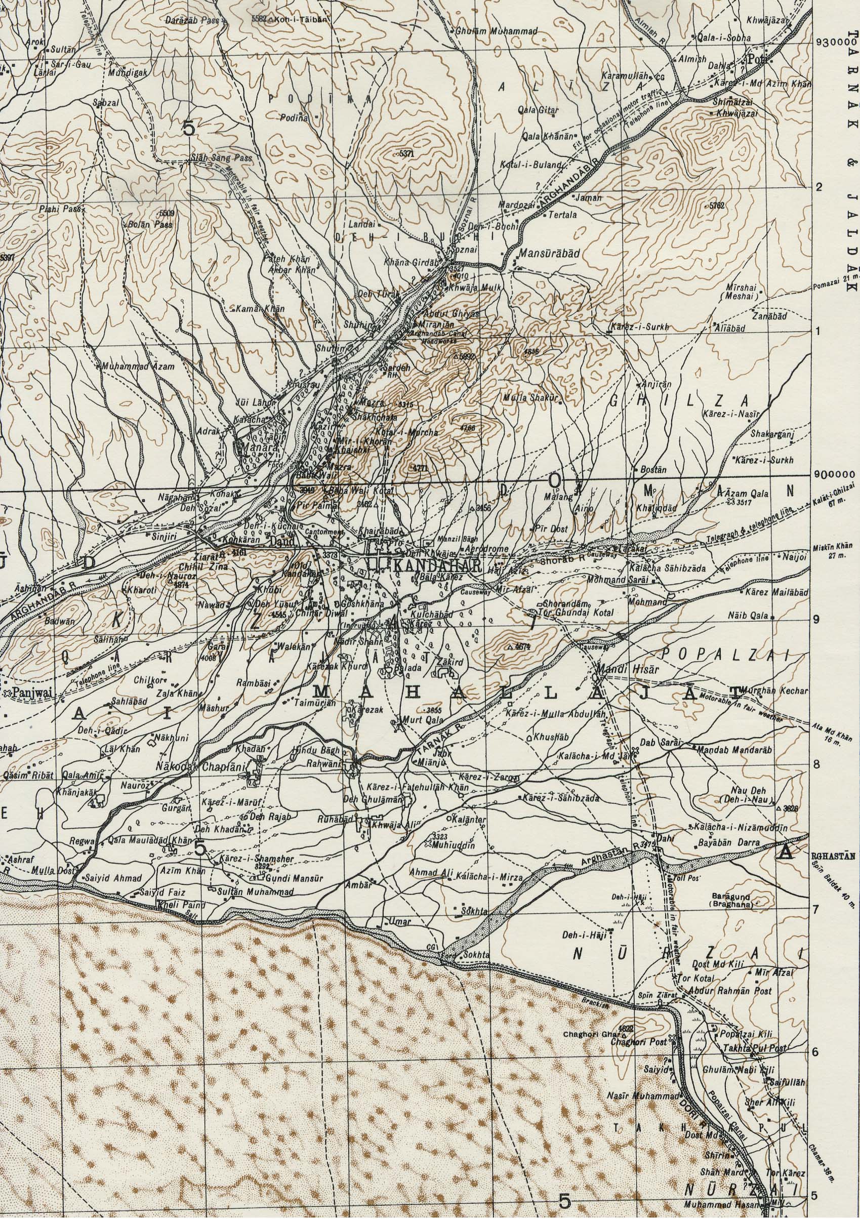
This is a cool Russian Map from during the Soviet times in Afghanistan and you can see how the city has grown..
 An old Russian (1985) map (we didn't have up to date maps at the time) so we would sometimes use these old maps. |
The mountain climbed does not have a name on this 1940's map but can be found North of Kandahar City located at 5315 feet just north of the road that crosses a pass marked as Kotal- i - Morcha just south of the 910000 latitude line on the map. Also interesting on this map is the feature marked as Old Kandahar which is a very steep hill just to the west of the city... that feature is the original castle (or fortification) that the Greek's built while here with Alexander the Great in 334 BCE. Where many Canadians have been in combat with the Taliban is in a place called Panjawi and the old fort can be seen on this map just west of the city and south of the high features on the edge of the map on the left.
 |
 |
This map shows the battle of Kandahar from 1892... the mountain we climbed is just past the top right corner of this map... (the road is the one that you see behind us in the photograph running from the old city to the top) |
No comments:
Post a Comment